
Algunas áreas del norte de Nueva Inglaterra ya han visto hasta pulgadas de nieve de la tormenta que comenzó el miércoles por la noche y continúa trayendo copos frescos a la región el jueves por la mañana.
Y aún podría caer más nieve más tarde en el día.
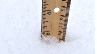
Aquí hay un vistazo a algunos de los totales de nevadas más altos en la región a las 9:30 am, según el Servicio Meteorológico Nacional:
MASSACHUSETTS
Haverhill: 5.8"
Merrimac: 5.3"
North Andover: 4.5"
Local


Ipswich: 4"
Andover: 4"
Topsfield: 4"
Amesbury: 4"
NEW HAMPSHIRE
Tilton: 7.2"
Pinkham Notch: 7"
Center Sandwich: 6"
Ossipee: 6"
Piermont: 6"
Lyme: 5.9"
Carroll: 5.8"
Freedom: 5.8"
Mont Vernon: 5.7"
Meredith: 5.5"
Tamworth: 5.5"
Jefferson: 5.2"
Chesterfield: 5.2"
MAINE
Litchfield: 6.5"
Raymond: 5.9"
Porter: 5.8"
Gray: 5.7"
Boothbay: 5.5"
Falmouth: 5.5"
Kezar Falls: 5.5"
Poland: 5.2"
Lisbon: 5.1"
Bath: 5"
Hope: 5"
Limerick: 5"
North Windham: 5"
VERMONT
Groton: 8"
East Burke: 7"
East Warren: 7"
Walden: 7"
South Burlington: 7"
Chelsea: 6.5"
Rochester: 6.5"
Elmore: 6.5"
North Pomfret: 6.4"
West Hartford: 6.3"
Huntington: 6"
Northfield: 6"
East Barre: 5.6"
Colchester: 5.5"
Williston: 5.5"
St. George: 5.3"
Cabot: 5.1"
Morrisville:
Landgrove: 5"
East Topsham: 5"